Tallapoosa River Trip, May 29-31, 2009
Heflin, Alabama
by Curt Cole
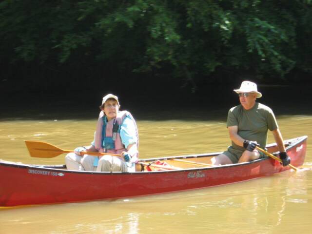
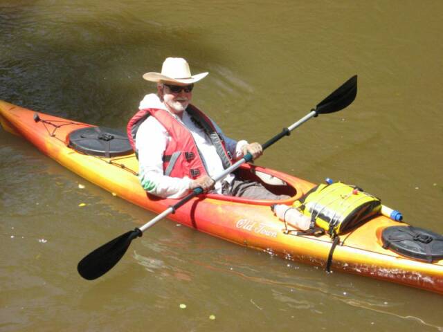
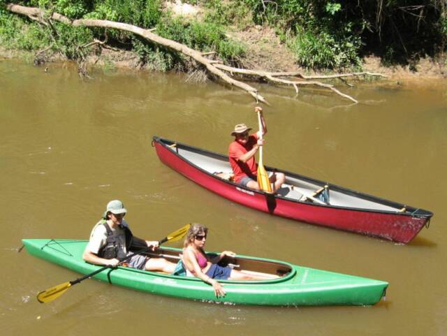
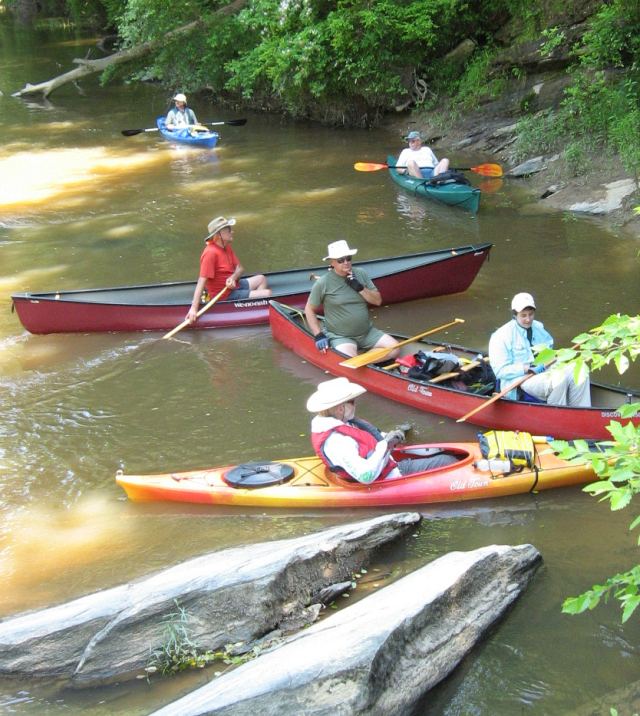
The Tallapoosa begins in NW Georgia, N of I-20, and flows SW into Alabama, eventually joining the Coosa to form the Alabama River near Montgomery. Eleven GWS members got together to paddle part of a 44-mile section designated the Loyd Owens Canoe Trail, in Cleburne county, Alabama. The trail has about nine official access points, mostly consisting of steps, but at least two points have concrete boat ramps. Participating were: Basil & Tammie Youman, Terry Neely & Margaret Clay, & Curt & Irene Cole in tandems, & Rob Apsley, Kerry Coburn, Gus Lane, Dave Buchholz, & Marty Dyche soloing.
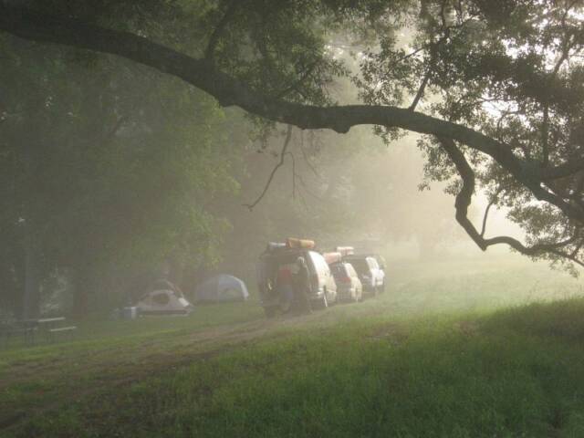
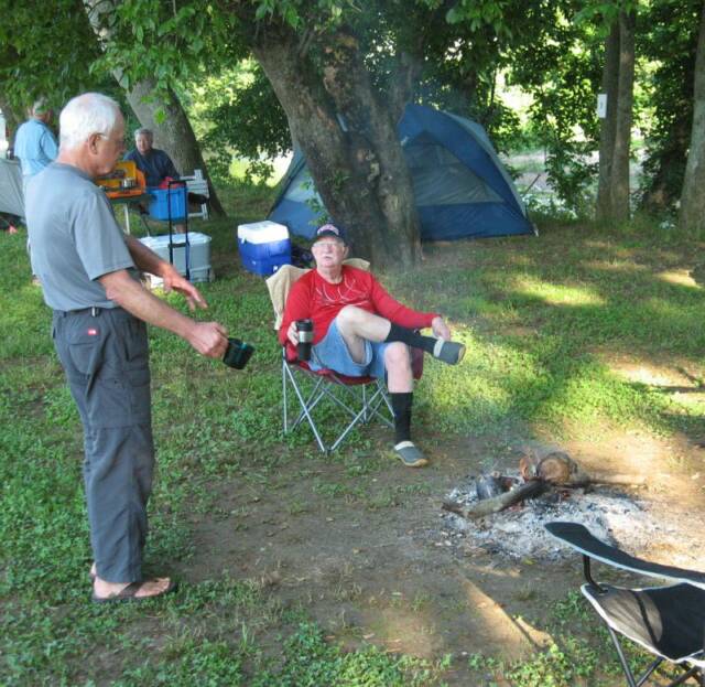
We all arrived Friday fternoon/evening and camped at Tallapoosa River Outfitters (TRO) on Hwy 46 south of Heflin. This outfitter has a small campground right on the banks of the river, under huge shade trees, and next to a cow pasture and huge green field. About all it lacks is a real shower. With six campers per site, it only cost us $5 each for the whole weekend. The owner seems real nice, and he rents boats and runs shuttles as well. No mosquitoes pestered us and nighttime temperatures in the mid fifties made everybody wish they'd brought a light jacket. Basil waded the river to gather firewood on an island and we sat around the fire till about 10:00 or so.
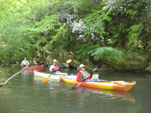
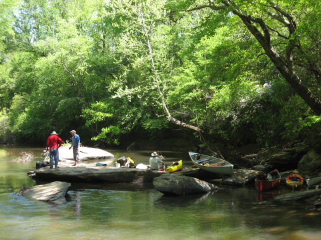
Most of us ate breakfast together Sat. morning at Marie's BBQ House. We left camp at 10:30 for the put-in, Dryden's Mill, on County Road 448. There are several campsites here, and the remains of the old mill dam. Starting the 14 mile paddle at 11:15, 1st time paddler Margaret was teamed with Terry in a tandem canoe. He kept up the lessons the whole time on the water and Margaret seemed to pick it up easily.
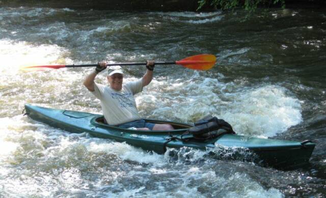
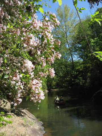
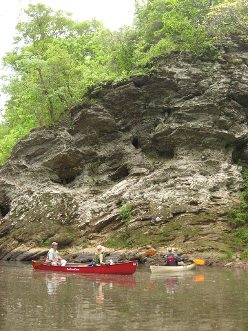
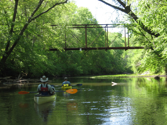
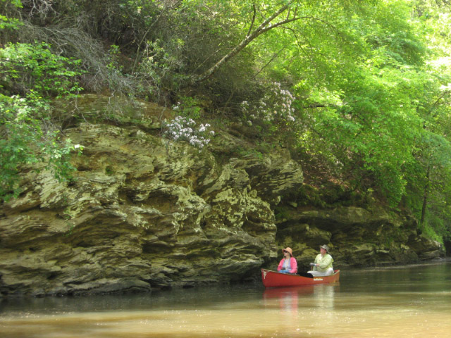
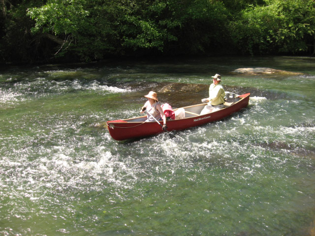
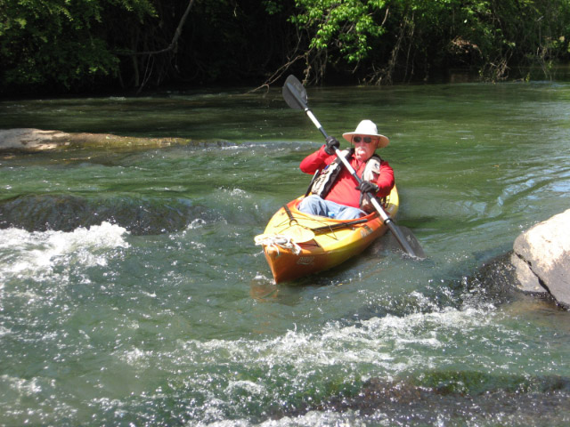
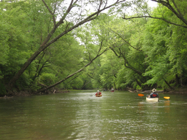
Probably no more than ½ dozen houses were seen on this day. Recent rains kept the river muddier than anticipated, but our amateur naturalists identified blooming plants such as silky dogwood, elderberry, virginia sweetspire, native white azalea, and lots of mountain laurel which were mostly past their peak. Lots of kingfishers were also seen, as well as barn & cliff swallows near camp. Cliffs maybe 10' high were often seen. The river is mostly flatwater with a few gentle shoals. Most of the group tried their hand at surfing the one notable ledge (1'-2' high) on this stretch. Not many sand or gravel bars were found, but we spent an hour for lunch on one. The sky was mostly clear and temps in the eighties. The trip took 5.75 hours, including lunch. Water level was 3.83', 345 cfs on the Heflin gauge. Plenty of water. Take out was at the ramp at camp.
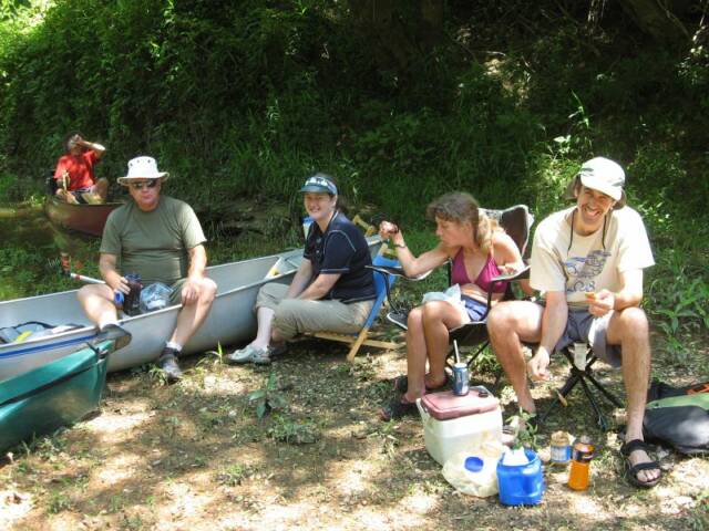
Most of the group headed in to Heflin for supper at Hometown Family Restaurant, where they had decent prices and plenty of food. Fudge, brownies and peanuts were passed around at the campfire.
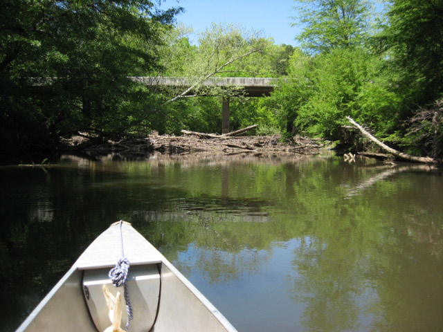
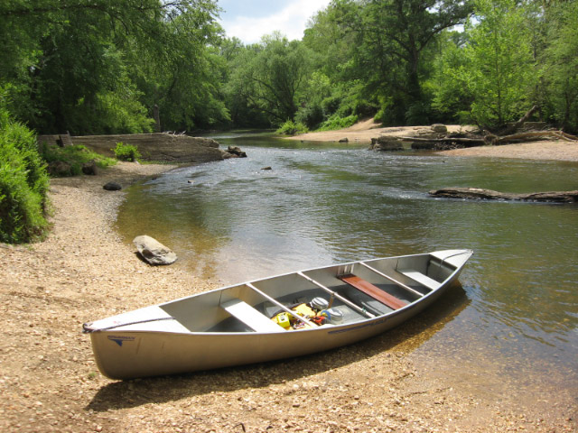
After Sunday breakfast at camp, we shuttled most vehicles to Co. Rd. 19, which had plenty of parking room, then left Basil's car at CR 84 (Evans Bridge Rd.) since he needed to get home earlier than the rest of us bums. We put in at TRO at 10:35 for this 12 & 7-mile run. More sand/gravel bars were seen on this section, a few more short shoals, and plenty of pretty scenery, again with little development.
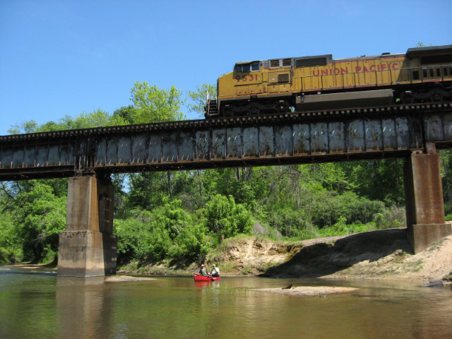
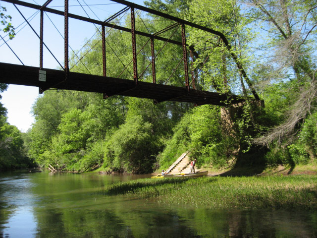
One kayaker became a member of the red-faced group most of us belong to—those who have capsized, when the current pushed him onto a rock. A number of old steel truss bridges spanned the river.
The trip ended just under 5 hours from the put-in, including 1 hour for lunch. Gauge reading was 3.66', 305 cfs. Another beautiful day paddling with a good group of people.
Most of us are anxious to paddle the river again, further upriver, and possible further down river. It's an easy beginner paddle.
This was my first time coordinating a paddle trip and I hope it was enjoyable for all. Thanks to all those who participated.
Tallapoosa River Paddle
April 13-15, 2012
By Curt Cole
Six Georgia Wilderness Society members paddled about 30 miles down the scenic Tallapoosa River in Georgia and Alabama on a beautiful spring weekend. Mountain laurel was very abundant in various stages of bloom. Also seen were native azalea (a.k.a. wild honeysuckle)& wild roses. Rocky cliffs of 10’-30’ were common. Numerous birds were seen, including great blue and little green herons, white herons or egrets, kingfisher and others. An otter slide was also pointed out by the ever-vigilant Terry Ross.
Sections of the river have been designated by Haralson County, Georgia as the Dub Denman Canoe Trail, and Cleburne County, Alabama calls theirs the Loyd Owens Canoe Trail. Neither has a lot of amenities, but all launch sites are decent places to put-in or take-out a boat, with usually decent parking for three to six vehicles. There is a small public campground at Dryden’s Mill.
We camped at Tallapoosa River Outfitters near Heflin, Alabama, with a grassy campground beside the river, and had the place all to ourselves each night. Meals were taken at various restaurants.
Friday’s trip was 9 miles from Broad Street in Tallapoosa, Ga. to County Road 72 in Cleburne county, Ala., taking just over 4 hours plus the lunch stop. Saturday’s Alabama paddle was 14 miles from Dryden’s Mill at CR 448 to the outfitter at AL Hwy 46, and took a little over 6 hours plus lunch. Sunday’s trip of about 7 miles, also in Alabama, took 2.5 hours plus lunch and began at CR 72 and ended at Dryden’s Mill.
Water level was 1.6’ and 115 cfs at the Tallapoosa gauge, 2.9’ and 175 cfs at the Heflin gauge. This was an adequate flow, with no one having to get out and drag their boat. There was only one log that we had to pull over, and one or two we ducked under. No rapids or shoals worth mentioning were encountered.
Participating were: Gus Lane, Joe and Jane Mangum, Tom Payne, Terry Ross, and Curt Cole.